Hello Family, Friends and curious readers.
Welcome back to my blog.
Yesterday I went on an amazing hike with my nephew Nick. We went to Barker Valley in the Clevelend National Forest in the Palomar Mountains in northern San Diego County (southeast of Temecula).
Thank you for coming with me Nick. We had a great time.
This is one of those hikes where the drive to it is an adventure in itself. The driving adventure really started in San Diego when taking the wrong exit off the 15 South (note: don't get off the FIRST 79 exit, that will take you to the 79 North, we drove 10 miles out of the way, then returned to the other direction back to the freeway where we saw a sign saying "End 79 S". So u-turned and went back the other way again seeing the signs saying we were on 79 N yet again, then finally Nick got a signal on his handheld and used his GPS app to find we were near Sun City north of our original exit, so then returned back to the 15 S to go a couple more exits to the 79 South). When taking the correct offramp we didn't know how far it would be to get to Palomar Divide Road (aka Forest Road 9S07) but we knew it was 6 miles before Warner Springs... so we still had 30+ miles to go on a state highway where daylight headlights are required. Nick saw the road sign as I drove past it because he remembered seeing the 9S07 - we were expecting Palomar Divide Road but only 9S07 was labeled. After a u-turn, and missing it again on the return, we finally went onto 9S07 passing through the open triangular metal road gate. Dang, we were in the West Virginia of So Calif!
The next 8 miles was on a winding, unpaved, bone-jarring road with barely enough width for a single truck, with sheer cliff drops on one side and a canyon wall on the other. I have never smiled so much while driving in my life. There were rocks in the road, steep cliffs, broken gashes, at times it felt like I was driving over curbs and open manholes, and even some times where the truck must have been at a 20° angle sideways! Check out the pics. Unfortunately you can't see the condition of the road but you can see the angle of the vehicle during a part of it. The last picture in this section was where we parked the truck at the trailhead.
That was the first time I took my truck offroad, and I think he may have actually grown a pair. Rocky Rose became a man yesterday. I am so proud of him. :-)


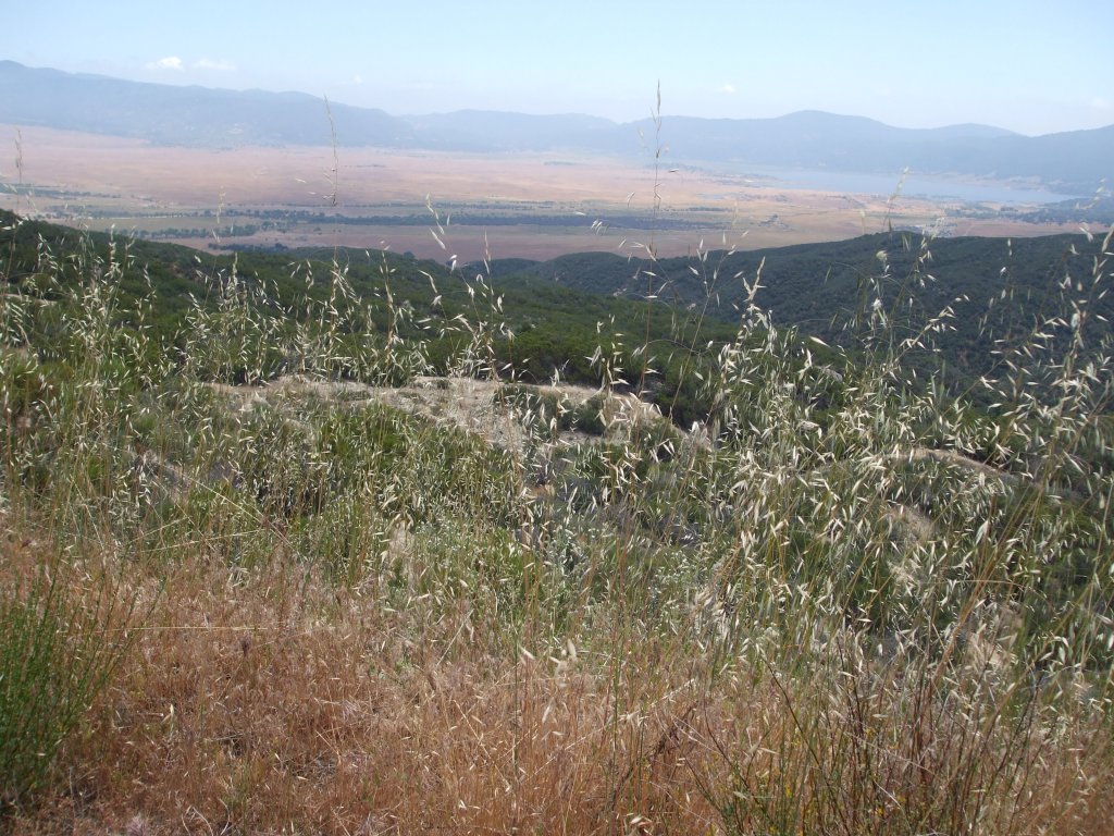
So now the actual hike begins. After leaving the truck at the top of the trailhead, with some 10 other trucks, we hike onto the old roadbed which is the beginning of the Barker Valley Spur trail. The hike gradually decends for more than 1½ miles before taking a sharp u-turn for another 1/10th of a mile to yet another u-turn, then goes on another 1½ miles on a zig-zagging course down into Barker Valley. The trail is really nothing much more than a rain gutter. The trail is seldom wide enough to walk side-by-side and much of the trial is covered with loose rocks and gravel, and in many places the brush grows onto the trail so that you have to push through the brush to pass. Once down on the zig-zag trail it becomes somewhat more rustic and course. The last part of the trail to the valley, ending that leg of the trail at the river, is not much more than dry river bed filled with boulders. But at the bottom there is a nice clear little stream that becomes the San Luis Rey River, and on the other side of that stream is a meadow that would make a great place to camp (there was a pair of campers there with their little Jack Russel - I don't know how they got the dog down there, that seems to have been difficult to do).
Our goal was to see the cascading waterfalls about a mile downstream. So taking the foot path along the river we trudged along. The path was barely defined, and at times it was even just flattened grass. The foot traffic here must be almost nothing. One of the hikers coming back our was had climbing rope as part of his gear.
Nick and I tried our best to find those falls. We got off the trail a few times, seen some fallen trees crossing a dry section of the river, and went back to the where the path meets the stream at the meadow to look for a different, more-defined, trail. The campers said we were on the correct trail but after tracking back we realized we were on some other trail that had similar characteristics to the true trail. So we headed back along the riverbed, pushing back the heavy growth in places, fighting nature it seems. The path became too vague and no one left any footprints so we must have strayed from the path yet again. Heck, of the 9 people we've seen on that entire hike I didn't see anyone else with sticks & twigs in their hair like we had. I didn't see anyone else with a bloody gash on his leg & knee like I had, or splinters in their palms like Nick had.
Noticing the time it was almost 6:00pm and the valley would become cold and pitch dark, aside from thelight of the moon, by 8:00pm so we needed to head back up the trail, like now.
I have to applaud Nick for being such a trooper. On the way back up I was a whiny old man. I was cramping, I was tired, I had to stop at least 20 times to stretch & catch my breath, and even took 2 potassium tablets ont he path back up. A "gradually sloping trail" my ass! Going back up those 1,000 feet and 3 miles were a true achievement to be sure. Nick said he was glad I was stopping but I didn't see him breaking sweat much. He did go through his full 70 ounces of water so maybe he was hiding his distress better than I was. :-)
We made it back to the trailhead where the truck was parked just before 8:00 and the shadows were long and the air was freezing. You can see a great final shot in the last picture where the clouds were dropping upon the mountains. We were only on the dirt road for about 10 minutes before full darkness hit. We travelled that trecherous dirt road most of the way down with just the light from my low beams (high beams just shot out over the road dissolving into the open space). I am so proud of Rocky Rose. He did us good. I don't want to wash him for a couple weeks now, his dirt and shrub scratches being his trophies.
So, here are some of the pictures. I kept about 100 pictures from the hike and I chose a good assortment from those for this blog. If you would like to see the remaining pictures from this hike you can see them on my gallery blog
here.
Thanks for reading this far. I hope you enjoy the pictures as much as I enjoyed the hike to take them.